


http://toolserver.org/~geohack/geohack.php?pagename=Philippines¶ms=14_35_N_121_0_E_type:country%28300,000%29
http://www.flashearth.com/?lat=14.583333&lon=121&z=15&r=0&src=ggl


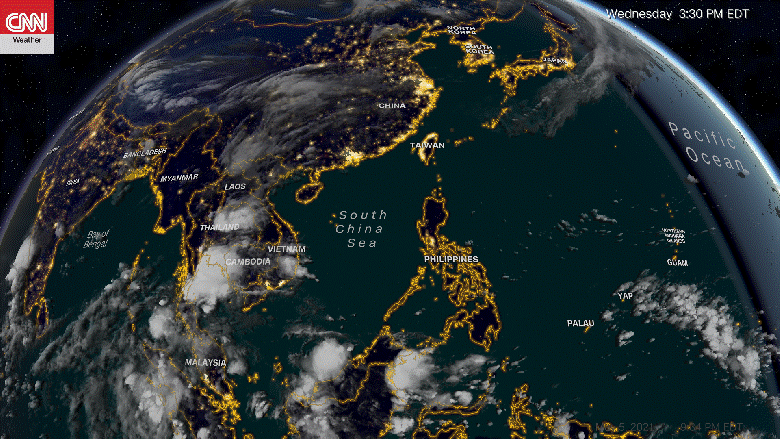
What causes typhoons ?
Warm water surface is the basic reason for the formation of the low pressure area. Warm waters surrounded by cold conditions inevitably create low pressure and unstable atmosphere above them. Water temperatures of at least 26.5 °C (79.7 °F) are needed down to a depth of at least 50 meters to start a typhoon.
Next is the abundant supply of water around the eye of the storm, ensuring that high humidity will fuel the typhoon constantly helping it grow in size. This is a giant that needs to feed constantly on water. Typhoons also need to maintain a distance of at least 5 degrees north of the equator to sustain and develop.
The basic condition for a typhoon to come alive is warm waters and with growing global temperature and melting polar ice caps,


Storm Track Statistics
| Date | Time | Wind (mph) | Pressure | Storm Type |
|---|---|---|---|---|
| Nov 03 | 06 GMT | 30 | -999 | Tropical Depression |
| Nov 03 | 12 GMT | 35 | -999 | Tropical Depression |
| Nov 03 | 18 GMT | 35 | -999 | Tropical Depression |
| Nov 04 | 00 GMT | 40 | -999 | Tropical Storm |
| Nov 04 | 06 GMT | 45 | -999 | Tropical Storm |
| Nov 04 | 12 GMT | 50 | -999 | Tropical Storm |
| Nov 04 | 18 GMT | 65 | -999 | Tropical Storm |
| Nov 05 | 00 GMT | 75 | -999 | Typhoon |
| Nov 05 | 06 GMT | 75 | -999 | Typhoon |
| Nov 05 | 12 GMT | 105 | -999 | Typhoon |
| Nov 05 | 18 GMT | 120 | -999 | Typhoon |
| Nov 06 | 00 GMT | 150 | -999 | Super Typhoon |
| Nov 06 | 06 GMT | 155 | -999 | Super Typhoon |
| Nov 06 | 12 GMT | 160 | -999 | Super Typhoon |
| Nov 06 | 18 GMT | 175 | -999 | Super Typhoon |
| Nov 07 | 00 GMT | 175 | -999 | Super Typhoon |
| Nov 07 | 06 GMT | 175 | -999 | Super Typhoon |
| Nov 07 | 12 GMT | 190 | -999 | Super Typhoon |
| Nov 07 | 18 GMT | 195 | -999 | Super Typhoon |
| Nov 08 | 00 GMT | 185 | -999 | Super Typhoon |
| Nov 08 | 06 GMT | 165 | -999 | Super Typhoon |
| Nov 08 | 12 GMT | 155 | -999 | Super Typhoon |
| Nov 08 | 18 GMT | 145 | -999 | Typhoon |
| Nov 09 | 00 GMT | 135 | -999 | Typhoon |
| Nov 09 | 06 GMT | 120 | -999 | Typhoon |
| Nov 09 | 12 GMT | 115 | -999 | Typhoon |
| Nov 09 | 18 GMT | 105 | -999 | Typhoon |
| Nov 10 | 00 GMT | 100 | -999 | Typhoon |
| Nov 10 | 06 GMT | 90 | -999 | Typhoon |

The Philippine Sea Plate or Philippine Plate is a tectonic plate comprising oceanic lithosphere that lies beneath the Philippine Sea, to the east of the Philippines. Most segments of the Philippines, including northern Luzon, are part of the Philippine Mobile Belt, which is geologically and tectonically separate from the Philippine Sea Plate.
To the north, the Philippine Sea Plate meets the Okhotsk Plate at the Nankai Trough. The Philippine Sea Plate, the Amurian Plate, and the Okhotsk Plate meet at Mount Fuji in Japan. Thickened crust of the Izu-Bonin-Mariana arc colliding with Japan constitutes the Izu Collision Zone.
The eastern side of the Philippine Sea Plate is a convergent boundary with the Pacific Plate subducting at the Izu-Ogasawara Trench. The east of the plate includes the Izu-Ogasawara (Bonin) and the Mariana Islands, forming the Izu-Bonin-Mariana Arc system. There is also a divergent boundary between the Philippine Sea Plate and the small Mariana Plate which carries the Mariana Islands.
To the south, the Philippine Sea Plate is bounded by the Caroline Plate and Bird's Head Plate.
To the west, the Philippine Sea Plate subducts under the Philippine Mobile Belt at the Philippine Trench and the East Luzon Trench. (The adjacent rendition of Prof. Peter Bird's map is inaccurate in this respect.)
To the northwest the Philippine Sea Plate meets Taiwan and the Nansei islands on the Okinawa Plate, and southern Japan on the Amurian Plate.

http://blank005.tripod.com/geology/tectonics.html


DAVAO RIVER VALLEYS
VALLEY - flatlands that are between mountains. These are called Valleys.

palm oil plantations in agusan sur
These large flatlands are called "PLAINS". These are more or less level areas. It is very easy to raise crops on plains. It is also easy to build towns and cities on plains


Karst is a term used world-wide to describe the distinctive landforms that develop on rock types that are readily dissolved by water. In Ireland, limestone (composed of calcium carbonate) and to a lesser extent dolomite (calcium and magnesium carbonate) are by far the most widespread rocks that show karst features. There is also a small outcrop of a younger softer rock also made of calcium carbonate – the chalk of Co. Antrim – which shows some of the features characteristic of karstic terrains. In other parts of the world, highly soluble rocks such as gypsum (calcium sulphate) and halite (common salt or sodium chloride) are abundant and they also exhibit karstic landforms
Karstified
limestones cover approximately one tenth of the land surface of the
Earth, but some 25% of the world’s population lives in these regions –
for example southern China, large areas of central and southern Europe
and much of central America. As the map on page x shows, half of the
Republic of Ireland is underlain by limestones, many of which are
karstified.
Typically, karst regions lack rivers and other surface
waters because the rain is swallowed up by fissures and conduits in the
rock and then flows as underground streams in caves. Eventually the
waters return to the land surface, often as large springs. Karst areas
are indicated by a general absence of permanent surface streams and the
presence of swallow holes and enclosed depressions. The water is
usually all underground in solutionally enlarged channels, some of which
are big enough to be termed caves.
The Chocolate Hills are conical karst
hills of limestone. These
hills consist of Late Pliocene to Early Pleistocene, thin to medium
bedded, sandy to rubbly marine limestones. These limestones contain the
aboundant fossils of shallow marine foraminifera, coral, mollusks, and
algae. These conical karst hills, called mogote, are created by a
combination of the dissolution of limestones by rainfall, surface water,
and groundwater and their subaerial erosion by rivers and streams after
they had been uplifted above sea level and fractured by tectonic
processes. These hills are separated by well developed flat plains and
contain numerous caves and springs. The Chocolate Hills are considered
to be a remarkable example of conical karst topography.
The origin for the conical karst of the
Chocolate Hills is described in popular terms on the bronze plaque at
the viewing deck in Carmen, Bohol. This plaque states that they are
eroded formations of a type of marine limestone that sits on top of
hardened clay. The plaque reads:
The unique land form known as the
Chocolate Hills of Bohol was formed ages ago by the uplift of coral
deposits and the action of rain water and erosion.
The plaque also makes reference to a
fanciful explanation of the origin of the Chocolate Hills that is
unsupported by any published scientific research, i.e. either Hillmer or
Travaglia and others, when it states::
the grassy hills were once coral reefs
that erupted from the sea in a massive geologic shift. Wind and water
put on the finishing touches over hundreds of thousands of years.
Self-published, popular web pages present
a variety of fanciful and less credible explanations about how these
hills formed. They include sub-oceanic volcanism; limestone covered
blocks created by the destruction of an active volcano in a cataclysmic
eruption;[14] coral reefs that were raised from the sea as the result of
a massive geologic shift; and tidal movements. [15] The lack of any
exposed or associated volcanic rocks anywhere in the Chocolate Hills
refutes the popular theories involving volcanic eruptions. These
theories involving either a sudden, massive geologic shift, coral reefs
being erupted from the sea, or tidal movements lack any collaborating
evidence and support among geologists.
BORACAY

davao gulf


AGUSAN MARSH

MALAPASCUA , OF CEBU

pppppppppppppppp
No comments:
Post a Comment